


Overview
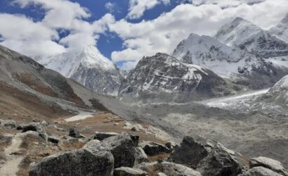
Manaslu Trekking area is situated close to the Annapurna district and offers the absolute best trips in the country. The core of the Manaslu locale is Mt. Manaslu (8163m), the eighth tallest mountain on the planet. Manaslu is canvassed in shimmering icy masses, wonderful towns, and beautiful landscape.
The most well-known journey in this district is the Manaslu Circuit Trek, an exhausting testing trip that is essential for the Great Himalayan Trek. Since the Manaslu locale is a confined region, it requires uncommon licenses, thusly restricting the quantity of adventurers that visit this region consistently. A journey to this interesting, lovely area makes certain to gain experiences that will endure forever.
High Himalayan Trekking offers rose traveling or plain tea house journeying for 10-day climbing trips as long as 30 days trips to the entirety of the above Manaslu objections. On the off chance that you are keen on investigating the Manaslu Region beneath are a portion of the schedules, or then again, we can liaise with you to by and by tailor your own agenda.
Itinerary
Early morning, drive to Arughat, exactly 7 hours by transport or a private jeep through the excellent scene. Subsequent to getting to Arughat we have an associating nearby transport ride to Soti Khola, at the bank of Budhi Gandaki River. Overnight in journeying lodge
The journey begins by following the Budi Gandaki River through the obscure sal backwoods, proceeding with steeply tough along a rough Cliffside. From here you can see the waterway’s white and wild rapids beneath. In the end, the path drops to the Gurung town of Labubesi and tracks with the riverbank until we arrive at the town of Machha Khola where we will go through the evening.
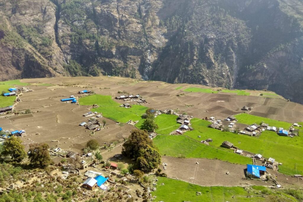
Today; we follow the canyon and proceed up the stream. Langur monkeys can ordinarily be heard playing in the wilderness high above, where there are additionally bigger Garung towns. We journey across the towns of Khorlabesi, Tatopani, Dovan, Thulo Dunga, lastly the social town of Jagat at the height of 1340m. Presently I can see the main Tibetan Buddhist culture-affected town in the Manaslu trail.
The following day, you will stroll to Salleri and slide to Sirdibas. The town invites you with a few gompas and Buddhist supplication banners. You can likewise attempt the neighborhood liquor in numerous visits on the course before you arrive at Phillip. At Phillip, you will have your licenses checked, and afterward you will proceed with the western bank of the waterway. The path is excellent with novel models over the rocks on the waterway bank framed because of stream water. Leaving the riverbank, you continue through backwoods of rhododendron, Himalayan pine, and the overhanging rocks on the transcending tops. These features embellish the path. On continuing further you cross the Siyar Khola extension and arrive at an intersection where the path isolates to Tsum valley to your right side. At last, you will arrive at Pewa, the last objective of the day. There are just two teahouses in the area where they serve essential food and an evening of comfortable rest. Seat has the best Dal Bhat in Nepal with the Shilong Acha is stunning.
In the evening, you can assemble around the chimney and offer your encounters with individual adventurers and local people before you head to sleep.
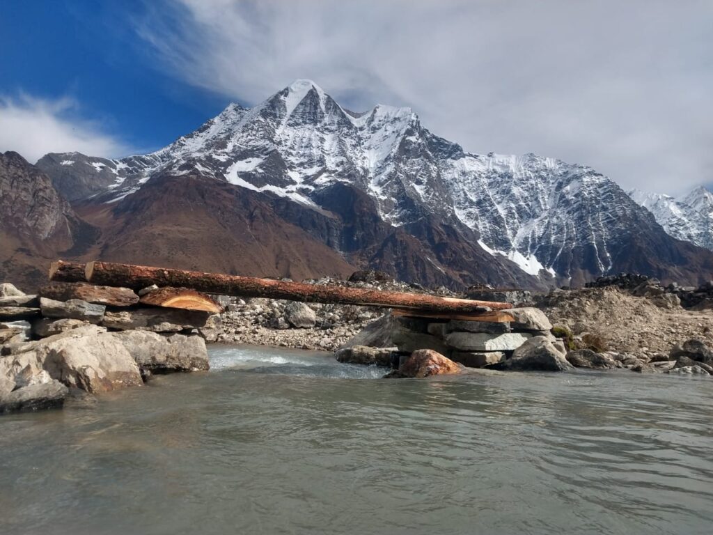
After the sun ascends, you will have your morning meal and start the trip of the day. Before you rise the winding path, you will stroll across the bamboo woodland to arrive at Deng. Moving further, you will cross an engineered overpass to move to Rana and Bihi Phedi. On the path, you can see White Faced monkeys visiting towns watching out for a free feed. The path at that point continues to Ghap through a few avalanche zones. Now, you should be extra cautious as you walk. Additionally, you should be mindful to your guide’s guidelines to keep up actual wellbeing. After the avalanche zone, you will follow the path up to Namrung. After about 1hr on the lopsided path, you will climb a crisscross from the waterway to the slick town of Namrung (2660m). The spot has the absolute best teashops, a café, and lay houses on the trip. A nearby finance manager worked for longer than 10 years in Hong Kong at that point got back to Namrung and assembled an eatery and inn that is current with Cappuccinos and WiFi.
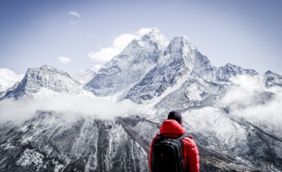
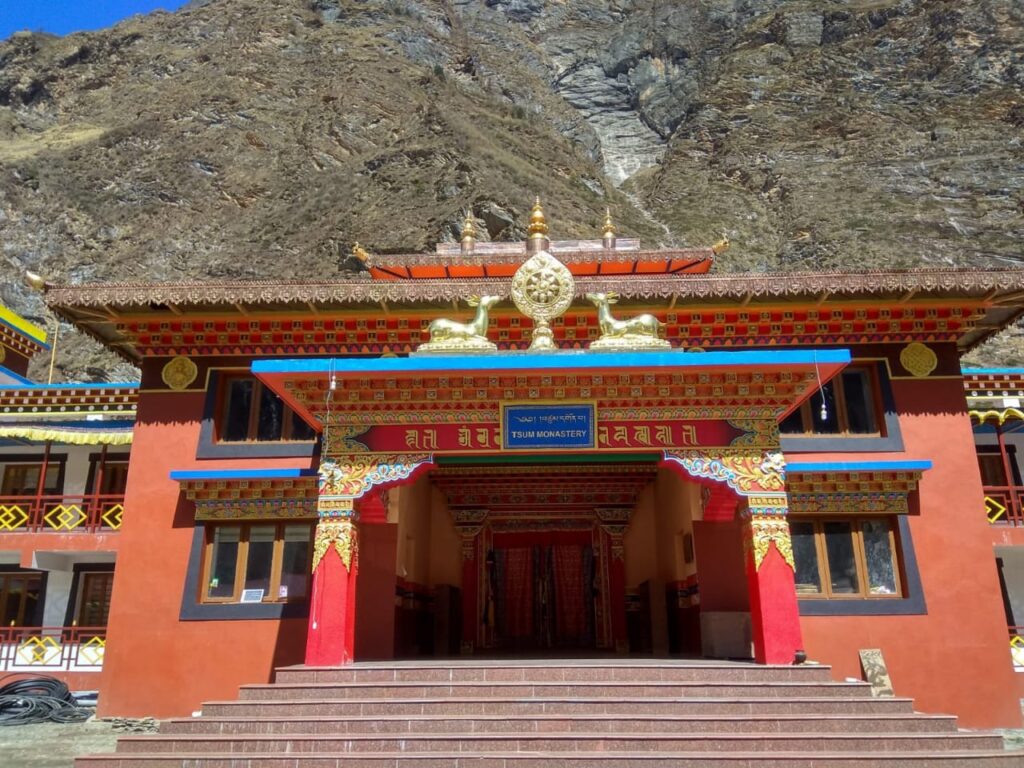
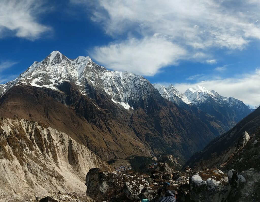
Seeing the ways of life of the Nubri public, you will begin the day. Investigating their Tibet-impacted commonplace way of life you will stroll past a few mani dividers, rich porches, and houses through Banjam to enter the fir, rhododendron, and oak timberland prior to moving to Lihi then to Sho. As you begin strolling, you will see a large portion of local people clad in conventional Tibetan dress. As you start further, you will see some fine works of art in the Kani (door curves) that you pass before Sho. Strolling across the rough slope courses, you will at long last arrive at Lho. From the spot, you can get the shocking perspectives on Manaslu (8163m) and Manaslu North (7157m). On this day, you will acquire a very high height, so you should walk gradually and check your body signs
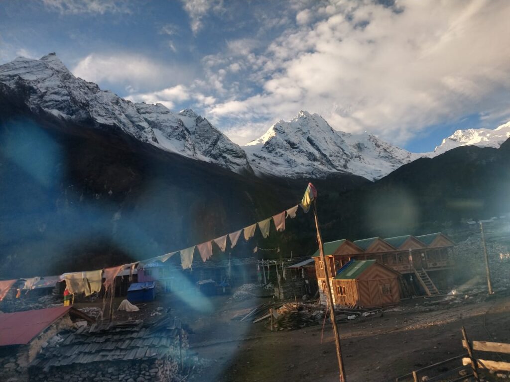
The following morning, you will begin with a short journey due to height reasons. On strolling, the beautiful perspective on Mt. Manaslu goes with you. You will stroll across the simple path to Shyapla on going through pine and rhododendron ravine with greenery and gin-clear stream. From Shyapla, you will stroll for nearly 60 minutes to arrive at Sama Gaon. When you enter the town, mountain sees blur, notwithstanding, the yak pastures and normal settlements will draw in you. Sama Gaon is the main town of the Nubri individuals which holds a huge gompa, numerous shops, a wellbeing post, heliport, and phone/wifi access, and so on
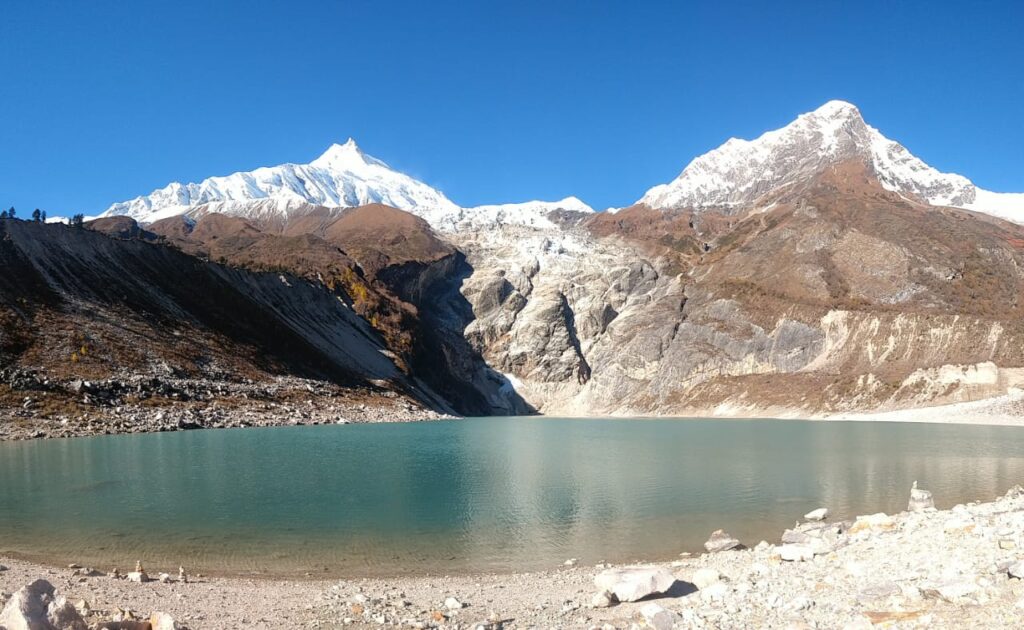
This is the day of acclimatization at Sama Gaon to forestall elevation related sickness. Furthermore, as an acclimatization climb, you will stroll to Pungyen Gompa on the east of the Nubri Valley. On this acclimatization climb, you can bring your lunch and take it at the rest stops for energy. Like different days, you will stroll across the thundering waterway which keeps you connected with for around 2 hours on the path. Once at the peak, you will get captivating perspectives on Manaslu. Close by, you will see numerous Himalayan Thars and Yaks brushing. Or then again, you can climb to Manaslu Base Camp which is on the north of Sama Gong. You can follow the path past Birendra Tal and go left onto the headquarters track. You will climb the consistent path, notwithstanding, the height may cause breathing trouble. Thus, you need to keep up body hydration and walk gradually. Continuing gradually, you will stroll toward the north of Manaslu ice sheet to headquarters at 4400m then return. Or on the other hand, you can climb to Birendra Tal, which is a short stroll from Sama Gong. This is an alternative in the event that you feel the requirement for a rest or on the off chance that you are discovering the elevation trouble.
On this new day, you will come to the more up to date objective to Samdo. Yet, as you are at a high elevation, you need to walk gradually thus, this is a brief day journey. You will see expanded yak pastures up a wide valley with long mani dividers, with an assortment of birds. From that point, you will leave the timberline and move to an edge across the wooden extension of Buri Gandaki before you arrive at white Kani. It is an adjoining town to Samdo, a beautiful town devoted to yak grouping. Once at Samdo, you can investigate the close by towns or you can climb to Samdo Peak. The Larkya La trail is on the left over the valley. You can likewise see the principle track for Tibet over the Larjyang La framing inclines on the Larkya La trail.
As a day for rest, you will stop at Samdo where you will go for a roadtrip to the Tibetan boundary. From the line, you can likewise see portions of Tibet and Nepal. On the off chance that fortunate, you can likewise observe the Yak train passing the boundary.
Once at the line, in the event that you look towards the south of Samdo Glacier you will get superb photographs with a tremendous serac close to the highest point of the ice sheet. You can likewise outline Blue Sheep, Pica’s, and Marmots in season.
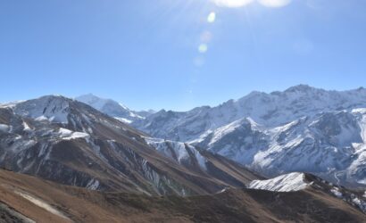
This is one more gutsy day at a high elevation. In this way, you should watch your body signs appropriately. Appreciating the grand perspectives on the chain of Himalayas you will walk gradually across the rough territories of the Manaslu district before you arrive at Dharmasala.
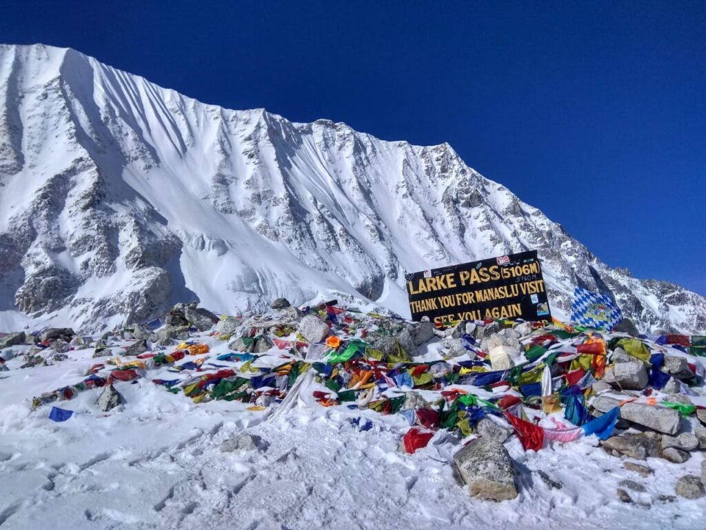
This is an uncommon day as you will stroll to the most noteworthy mark of the path. You will stroll to Larkya La Pass (5160m) on this day. In terrible climate and in the snow, the walk could be very difficult yet, it is feasible. You will cross the pass before evening so you need to get up right on time and leave the teahouse very early. This is the difficult piece of the journey however in the event that you walk consistently, you can stroll to the pass effectively. The dazzling perspectives you will observer once you remain at the pass make the excursion more edified. You will get perspectives on Himlung (7126m) close to Tibet and Kang Guru (6981m) and Annapurna II (7937m) in the Annapurna Range .Investing your extraordinary energy at the pass, you will stroll down for around 3 hours towards Bimthang for an overnight stay. On dropping, you will get perspectives on immense icefalls and mountains every which way, Pongkar Tal between the Pongkar and Salpudanda Glaciers.
This is the last day you will stroll on the path of the Manaslu district. On climbing downhill, you will stroll through the lavish backwoods brimming with verdure including rhododendron shrubs. Strolling back across the Dudh Khola, you will stroll to Karcher for lunch. In the following hour, you will see numerous indications of a chilly flood, with tree trunks crushed and banks sabotaged, the track getting very unpleasant. What’s more, the path drops to Gurung Goa, the primary genuine town since Samdo. The valley turns out to be more horticultural and rich as you pass fields and hedges of oak and rhododendron, remaining on the north (genuine right) bank until Tilije. From that point, you will proceed with your walk around Dharapani and proceed to Tal.
In the event that you feel outrageous sluggishness, you can take a jeep from Tilje to Besi Sahar. From that point, you can return a ride to Kathmandu. Or on the other hand, you can return a transport to Kathmandu from Tal. After the 7-8 hours drive, you will rest in one of the complex lodgings in Kathmandu.